A flexible family walk at Oak Point
Give the group a turnaround goal before setting out into Plano’s largest preserve.
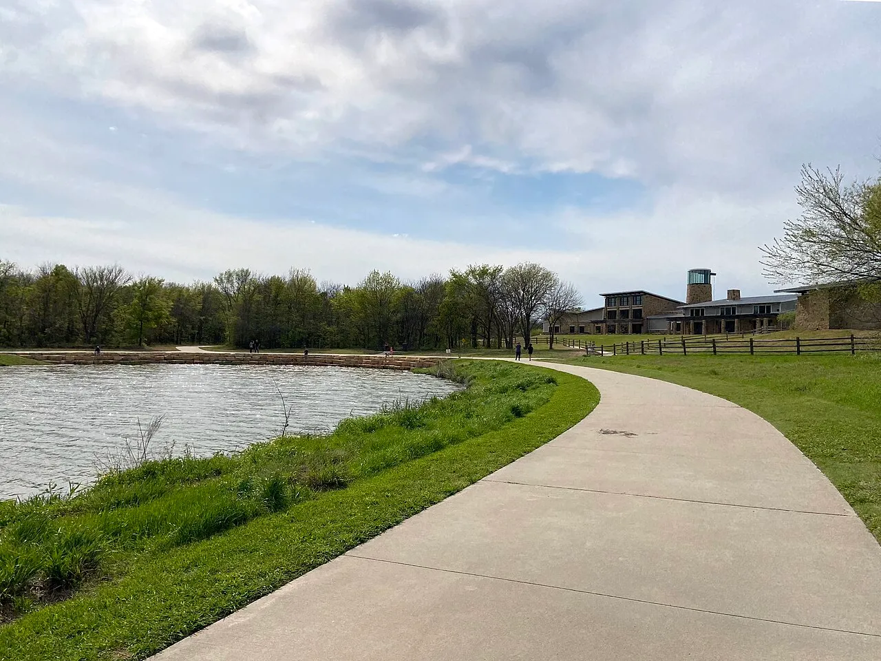
At Oak Point Park and Nature Preserve, planning a family walk can begin with a question about footing. Some people want a smooth route and a place to turn back whenever it suits them. Others want to spend part of the afternoon on a natural surface near Rowlett Creek. You can give the group a shared start and decide later whether to add the second kind of trail. The city's maps give you a way to make that choice before the outing turns into an unexpectedly long loop.
Start with the City of Plano's nature preserves and trails directory. Plano identifies Oak Point as its largest park, at about 800 acres, and shows how far the preserve extends between the roads around it. A park this size can have several places that make sense to one person as a starting point. Give the group a specific entrance, a named feature to look for and permission to finish the outing early if the first part has what they came to see.
Choose an Oak Point destination rather than a park name alone
Visit Plano's Oak Point Park and Nature Preserve guide lists 5901 Los Rios Boulevard for the preserve. The city's natural surface trail map shows the Nature and Retreat Center and other references. Choose one of the actual places on the map as the basis for meeting, then confirm the approach everyone intends to use. Plan around a feature visible from a permitted public route if you only need an outdoor landmark. The center's facilities and availability for a particular purpose are a separate question to check with the city.
Say “park and nature preserve” in your directions if that is where the visit begins. The city also has a separate Oak Point Recreation Center listing. A search for the shorter name can give two people different results. If you are arriving separately, give the location and landmark together and agree where to wait if the expected approach is not available. A parent holding onto a stroller or helping someone out of a car should be able to find the group without choosing among several distant spots on a map.
Read the map for what goes under your feet
Visit Plano's guide distinguishes concrete pathways from soft surface trails along Rowlett Creek. Look for the surface distinctions before choosing a stretch of route. A family may want a firmer surface because of equipment, the pace they expect to keep or the amount of time they have. Someone else may be happy to spend the same short time looking for a different view along a natural path. The surface shown on the map helps you make the first choice. Consider the actual grade, condition and room to pass when you arrive. If an access need determines whether somebody can join, ask the city about the particular route you are considering.
Use the natural surface map to name a junction or trail you might look for. The map identifies Caddo Trail and the Rowlett Creek Trail among the paths in the preserve. Those are names you can use to check where one proposed stretch begins and ends. A map distance may describe an entire named trail. Decide how much of it your group actually intends to follow and allow for the route to that trail from the start. If you have allotted enough time to go a short way and return, keep the original destination clear, especially when a tempting connection leads toward another part of the preserve.
Agree on the first decision point while everyone is together
Name the earliest point where you could stop and still feel that the outing worked. It might be a signed junction, a view across open ground or a place you can recognize and use to turn back. Give a child a job they can do on the way, such as finding the first sign that names a trail. Someone who has trouble estimating the distance can plan around an identifiable location rather than counting minutes at a pace that may change. At the first stop, ask everybody whether they want to add anything and whether the return still feels manageable.
Suppose one person wants to try a natural trail and another is content with a short walk on concrete. Start together on the firm route you have confirmed. At the decision point, look at the map and conditions. Choose whether to return together or spend a little longer on a suitable segment. If adults intend to split into two groups, agree on who is with each group and where they will meet again. One part of the outing can end without requiring everyone to take the longer option. The better plan is the one people can carry out with the time they have that day.
Save a connected park for a different outing
Visit Plano's guide to local parks and trails describes a trail connection between Oak Point and Bob Woodruff Park. The connection gives you another possible trip to look up later. For the first walk, trace the route back to your starting place before following a sign toward another named park. A map of a connected system can make it easy to choose an interesting destination without seeing how much farther it takes you from the people waiting for you. Look up the connecting route as a separate plan if one member of the group wants to use it.
If someone does decide to visit a second park, give that part its own meeting and return arrangements. A person who comes along only for the initial walk should know where they are getting back to and whether they need to wait for the rest of the group. Keep the difference clear in the directions you share. “Our walk ends at the first turnaround, and the connection is a separate trip” is a useful way to set expectations. You can return to the map after the group has tried one simple route and knows how much of the outing they want to share.
Spend time noticing the shift from open land toward the creek
The Texas Parks and Wildlife Department's Lake Lavon Loop guide describes Oak Point within the Blackland Prairie region and places the park's natural areas in the context of a visit to the Rowlett Creek corridor. Use that distinction as a question for the group. Look from a permitted path and see how close the trees are, where the view widens and whether the wind or shade feels different when the surroundings change. You can observe a transition without reaching the water or setting a goal to see a particular kind of wildlife.
Make the question specific enough for a child to answer. Ask them to point to the part of the view where the open sky gives way to a line of trees. See whether the boundary looks different after you take a few steps. A person who wants to pause while someone else studies the map can use the same place to look at the size of the open area or listen for a sound they can distinguish. You can finish the visit after that comparison. A short walk that gives the group one clear observation can be a more useful first visit than one that reaches several places without time to notice the change between them.
Check the park information you need for the day you go
Plano's visiting the parks page links to information about drinking fountains and restrooms, including closures. Use that information if one of those facilities is important to the trip. Bring what you need on the walk even if a facility appears on the map, and verify current access locally. Pay attention to conditions on both kinds of path. A natural surface that suits the group in dry weather may call for a different decision after rain. If the projection for the outing leaves no time for a change, shorten it at the planning stage and keep a second route available to check.
Consider who is likely to need a break first and where the group can step clear of others. That changes how you use a trail junction or a stretch with less room to pass. Keep an alternate return on the route you already know instead of improvising a shortcut to a different park entrance. It is worth giving a little attention to conditions on the way out too. If the return includes a grade, heat or a crossing, include that in your decision about how far to go rather than making the decision at the last item on the map.
Keep another route as a question for next time
After returning, write down the start you used, the surface you walked on and the point where the group made its decision. Name one thing that would change the choice on another visit. A family that found a comfortable first stretch may want to add a little time near a wooded section. A group that would prefer to stay on a firm surface can make the next outing about a view or place at which to pause. By bringing a question back to the map, you give yourself a reason to explore a new section without making everybody commit to it before they arrive.
The park's size makes it easy to keep a new part of the preserve for later. End with enough time to retrace your steps together and enough of a memory of the way out to explain it to someone else. That is a useful plan for the next family member who wants to know where to start. For more local outdoor ideas, browse the Plano Beacon archive.